Landslide Susceptibility
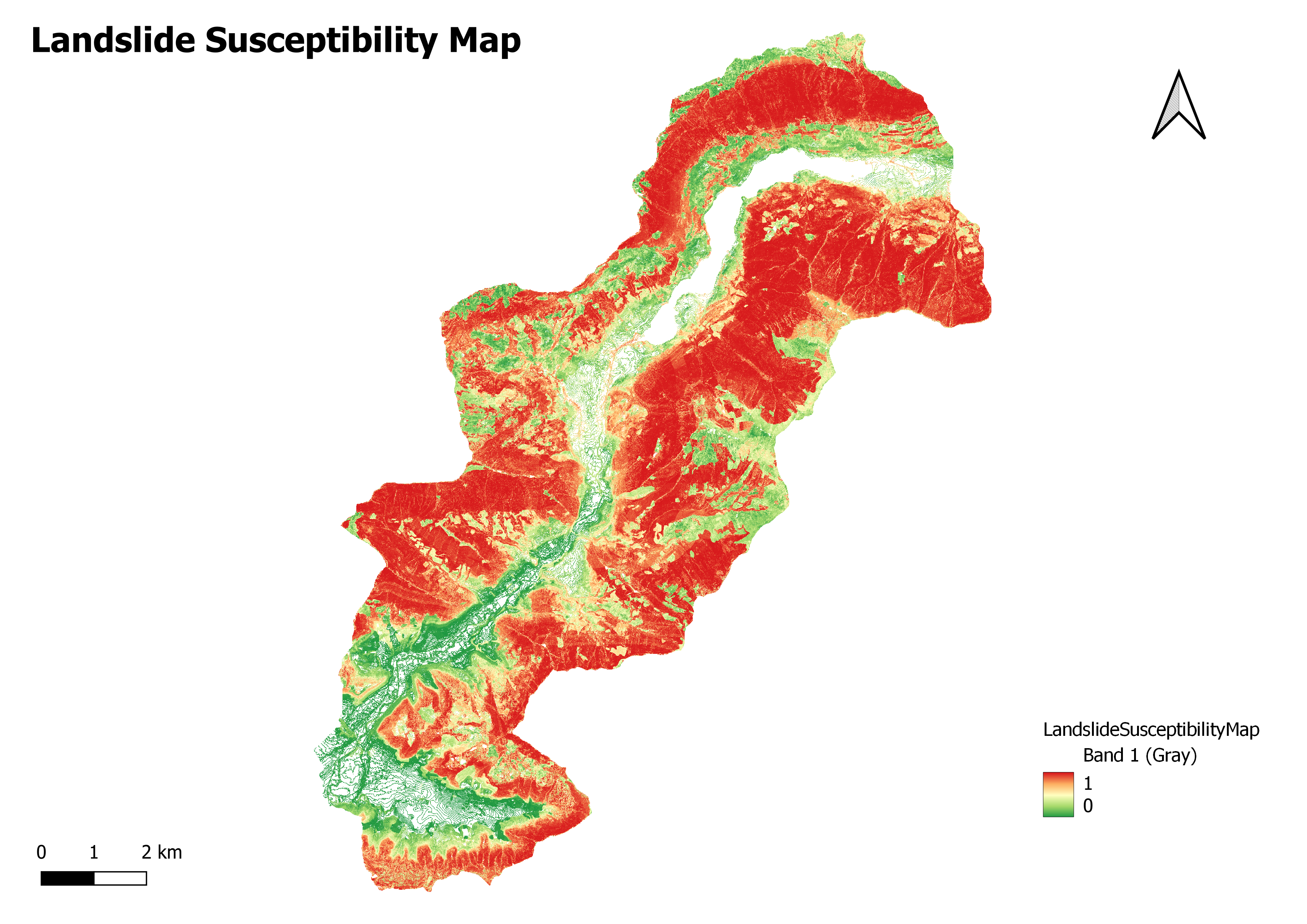
Landslide susceptibility mapping is a process that involves assessing and mapping the likelihood or probability of landslides occurring in a given area.
It aims to identify areas more susceptible to landslides based on various factors and parameters.Landslide susceptibility mapping provides valuable information for land-use planning, infrastructure development, disaster risk reduction, and landslide hazard management. By understanding the areas at higher risk, appropriate measures can be taken to mitigate and minimize the potential impacts of landslides.
ErrorMatrix
Data Collection: Gather relevant data, including geological maps, topographic maps, slope information, land cover data, rainfall data, soil data, and historical landslide records. This data helps identify and analyze the factors that contribute to landslides.
Inventory and Analysis: Creating an inventory of existing landslides within the study area and analyzing their characteristics, such as type, size, location, and triggering factors. This analysis provides insights into the relationship between landslides and the influencing parameters.
Factor Evaluation: Assessing and evaluating various factors contributing to landslide occurrences, such as slope steepness, slope aspect, soil type and properties, land cover, geological conditions, hydrological factors, and rainfall patterns. Each factor is assigned a weight or rating based on its influence on landslides.
Model Development: Developing a landslide susceptibility model using statistical or machine learning techniques. The model integrates the analyzed factors and their weights to generate a quantitative or qualitative representation of landslide susceptibility across the study area.
Validation and Verification: Validating the developed model using independent landslide data or testing sampled points. This step involves comparing the predicted landslide susceptibility with actual landslide occurrences to assess the accuracy and reliability of the model. Susceptibility
Mapping: Generating landslide susceptibility maps that classify the study area into different zones or categories representing varying levels of susceptibility. These maps help identify high, moderate, and low landslide susceptibility areas.